THE LATEST CEDAR RIDGE EXPANSION ATTEMPT: 68V-C

THE LATEST CEDAR RIDGE EXPANSION ATTEMPT: 68V-C
PARCEL 68V-C (PICTURED) HAS BEEN SAVED FROM DEVELOPMENT!...FOR NOW. The voters at the Annual Town Meeting on May 13, 2013, rejected the town's proposal to authorize the land for sale!

Tuesday, May 14, 2013

Parcel 68V-C: a Save and a Beauty!


Thanks to everyone who voted NO to the sale of town-owned Parcel V-C at Town Meeting on May 13, denying the destruction of this forest.

Thursday, April 25, 2013

JUST VOTE “NO” ON THE DESTRUCTION OF PRIME HIKING FOREST IN WILBRAHAM


Plans for the deforestation of Parcel 68V-C (above). The White Cedar Swamp is adjacent to this property to the right.


Whose land is parcel 68V-C off Stony Hill Road? It’s yours, the taxpayers’ land, that is in danger of being sold for housing development. It is used extensively by Wilbraham residents for outdoor recreation and is located between two protected reservations: the White Cedar Swamp Conservation Area and the McDonald Nature Preserve.

Because this 20 acres of beautiful hardwood forest is owned by the Town of Wilbraham— and has been enjoyed by townspeople for nearly four decades—it has been assumed by many that 68V-C is protected from development. But it isn’t.

On April 11, the Board of Selectmen put an article on the Annual Town Meeting warrant that may wreck the woods forever. A “yes” vote on May 13 would be in favor of the town of Wilbraham authorizing this “surplus” property for sale.

It has been dismissed as “underutilized” land even though it is often used by hikers, runners, dog-walkers, cross country skiers, horseback riders, and snowshoers. You will hear it called “excess” land, despite Money Magazine listing Wilbraham in its 2007 list of  “Top 100 Best Places to Live” partially because of our “large areas of preserved open spaces.” 

You will be told that selling this land will bring in much-needed tax revenue. In fact, according to a review by the American Farmland Trust of many “Cost of Community Services” studies, including studies in 10 Massachusetts towns, the median cost to provide public services for residential developments is $1.19 for every dollar of revenue they raise— vs. just 37 cents to maintain open space. 

This is not a project that is in the best interest of the residents of Wilbraham. It will have a significant negative impact on the rural character of the town and heavily increase traffic on Stony Hill Road.

A developer has been actively pursuing 68V-C. Will he get it? It starts with a two-thirds yes vote by the town’s registered voters at the Annual Town Meeting May 13 (7 p.m. at Minnechaug Regional High School, Article 50). To paraphrase the saying of a former First Lady of the United States: Just vote no.


 Envisioned for the entire Cedar Ridge Complex: between 190 and 205 units. (Click on the photo to enlarge.)


There will be a public meeting on the Cedar Ridge proposal on May 8  at the Middle School at 7:00 p.m.


The drawings above are being touted as the development options, with 68V-C built out on the bottom. (Click on the photo to enlarge.)

Tuesday, April 2, 2013

Three Seasons of Fun in the White Cedar Woods


One great thing about the White Cedar Swamp is its year-round appeal, although the actual wetlands are pretty much only hikable in the winter when the swamp freezes over. 

The photo above isn’t even of the White Cedar Swamp reservation per se: the meadow in the foreground is town land to the west of the “official” swamp, but the land under the power lines and the woods on the left is owned by the Western Mass Electric Company. Thankfully, access to the WMECO pathways was granted in an easement to the town.

In fact, when I refer to “White Cedar Woods,” I tend to include the all the forests that stretch from Boston Road to Faculty Street, and some of that land is indeed private—for example, the woods owned by Wilbraham & Monson Academy and the Cedar Ridge housing development.

That is where my naiveté comes in. I hike on all this terrain, and I expect it to stay in its natural state: one contiguous swath of beautiful land. When I hear that Cedar Ridge plans to essentially divide the woodlands in half by driving a wedge of housing through it, I bum out. Still, I am a big boy, and I know the town let it happen in 2006 by approving the initial stage of this development. But when I hear that the town intends to sell ADDITIONAL land in this area to a developer—presumably Cedar Ridge—to build a total of nearly 200 housing units on both parcels, my blood begins to boil, because I had assumed that town land would be “protected.” I had assumed that the town would preserve this land because of its natural beauty. THAT IS SIMPLY NOT THE CASE.

But let’s forget this outrage for a few minutes and have some fun in the woods through three seasons: the fall of 2012, the winter of 2012-2013, and the spring of 2013.

Fall 2012: The Woods Behind Faculty Street


Some of the views of the wetlands from these trails (above) show the swamp in its primeval state—it was never converted into farmland when much of Wilbraham was deforested for agriculture.


The microburst in June of 2011 felled many trees in this area and erased good paths, but the main trails have been cleared and they are maintained fairly well.


You never know whom you’ll meet on these trails. Smile!


I was puzzled by this black band around the tree until I got closer and discovered it was a wildlife camera (above). So someone has film of me checking the camera out. Smile! You’re on a wildlife camera!


The paths that originate at the Academy extend to the power lines, and if it has been dry for a while, you can usually hop over a stream to the Stony Hill Road side of the White Cedar Woods. But someone went to the trouble of chopping down a bunch of trees (pictured above) to block access to ATVs and motorcycles.


I climbed over, under, and through the blockage, but damn! The stream is as wide as hell! I could have tromped through the vegetation on my left with minimal soaking of my boots, but I said, “The hell with it,” turned around, and called it a day—but not before I found this deer skull:


You can access the Academy trails off Faculty Street: they’re to the right of the new football field beyond the tennis courts. Once you enter the field area, you’ll have to walk counter-clockwise on the right of the clearing and keep your eyes open, but if you’re alert, you’ll find a couple of trailheads.


Winter 2012-2013


On cross country skis I check out the large, signature pine grove on the Cedar Ridge land. It’s too bad the middle of this view, to the left of the pine trees, will be someday be ruined by buildings, so I’ll enjoy it while I can.


These woods are ideal for cross-country skiing, but when the snow gets incredibly deep—as it did this past winter—it’s always good when someone takes a snowmobile out after a heavy snowstorm to provide a decent skiing surface.


The funny thing about the winter of 2012-2013 was that there wasn’t really much snow until late in the season. And it took a while to get cold. I brought the snowshoes out in late December, but the swamp hadn’t frozen solid yet (above). Usually, by this time, the ice is thick enough to support my weight.


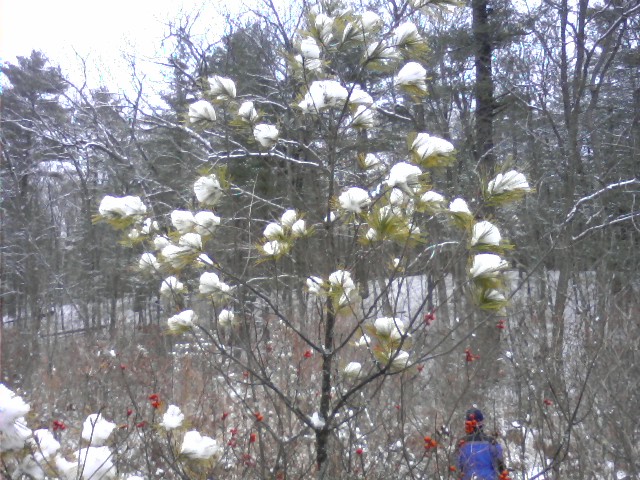
My son (face obscured) stands next to a  “Christmas Tree” with snow puff ornaments (above) and trudges on snowshoes on one of the swamp area’s rare hills (below).


I am partial to snowshoeing or cross country skiing late in the day, when the snowmobiles have already made their tracks.

Spring 2013


In the swamp woods, the fog comes on big bobcat paws. Above, the mist obscures the pine grove on the Cedar Ridge land. Yep, I’m going to repeat it again, ad nauseam: that’s where housing units are going to be built someday.


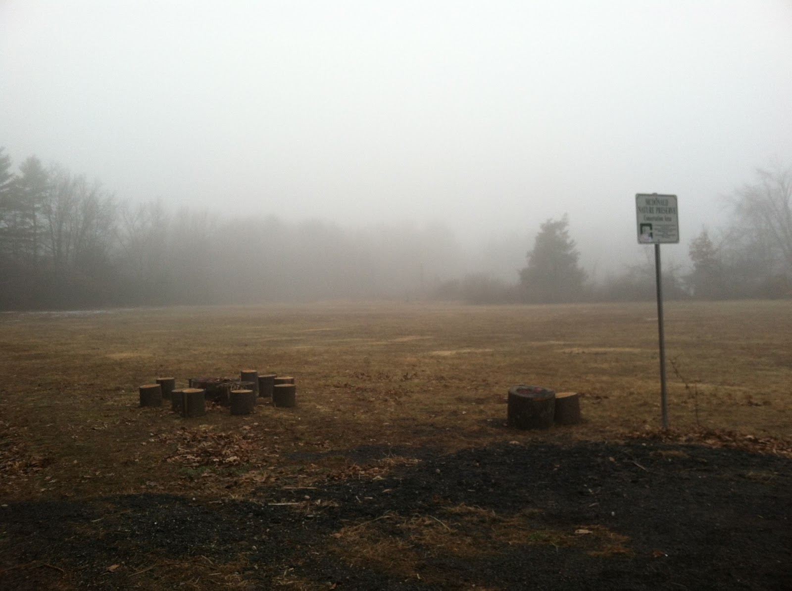
The foggy view from the McDonald Nature Preserve parking lot.


A remnant from the area’s agricultural past: an old tiller hides in the brush on the path that leads to the Wilbraham Middle School soccer fields.


These days you have to watch your step because there is plenty of horse riding on these trails, especially on Sundays.


No matter how often I hike here and think I know the woods like the back of my hand, I discover a new side-trail—or a deer stand. This one is off the Alton’s Way trail near the McDonald Nature Preserve.


I discovered several cellar ruins about two years ago. This one is a little off the Cedar Ridge land on the west side of the power lines on the south side of the clearing: a stairway to the old Oaks Farm past.


The other foundation (above and below) is on town land known as 68 Brainard Road—"Schedule C,” or better known as “68 V-C.” On April 11, the Board of Selectmen, in its infinite wisdom, decided to put an article on the Annual Town Meeting warrant that may wreck the woods forever. A “yes” vote on May 13 would be in favor of the town of Wilbraham authorizing this "surplus” land for sale to Cedar Ridge or another developer. Such an ill-advised move would require a two-thirds vote by the town’s registered voters at the meeting. To paraphrase the famous saying of a former first-lady of the United States: JUST VOTE NO.

A separate informational meeting on the Cedar Ridge proposal to build on this property is tentatively scheduled for May 8 at the Wilbraham Middle School. Stay tuned, folks. This is YOUR land the town is trying to sell.


Monday, November 12, 2012

The 26-House Subdivision-From-Hell Off Washington Road


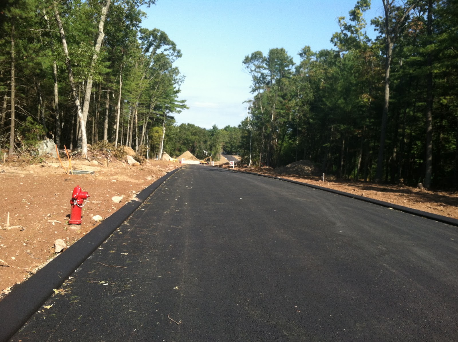
Okay, folks, forget future Cedar Ridge housing expansion for a moment and look north for some deforestation that's taking place RIGHT NOW. Nicola Way: a road cutting right into the forest north of the White Cedar Swamp.


Well, it’s finally happening: construction began this past summer. I was in denial for so long, because this project was years in the making and momentarily stalled, even though it had the blessing of the Planning Board. The 26-single-family home Washington Heights subdivision off Washington Road—going far into the woodlands north of the White Cedar Swamp—originally won approval from the Planning Board back in 2008 despite opposition from area residents.

Neighbors, insisting that the project didn’t comply with the town’s zoning ordinance, appealed the Planning Board’s decision, and the Hampden Superior Court case was filed on January 5, 2009. But the developer won the court battle and the trees began to be mowed down last June.


The first house is going up. Hooray for “progress” in a down housing market at the expense of a beautiful area of woods.

The subdivision, when completed, will cut a huge hunk out of the north side of the White Cedar Swamp’s nearby woods. Part of the residents’ opposition was the amount of traffic the development will generate: an estimated 500 cars a day, according to the traffic engineer, who said that there may be some increased delays at Boston Road area intersections during evening commutes.

“Unfortunately, all streets lead to Boston Road,” said the Planning Board. Unfortunately, the subdivision wrecks an area of the forest in the same wildlife corridor as the White Cedar Swamp, which is already seeing development pressures from the other side: the Cedar Ridge housing development.


In case you’re wondering if the Nicola Way development ruins any good established hiking trails—IT DOES. I was following a horse trail from the McDonald Nature Preserve on November 11, and all of a sudden I saw a sign informing me it’s private property (pictured above). I kept following a path anyway, and it stops on Nicola Way, right here: 


The surreal part of it is that my walk back to the McDonald Nature Preserve revealed horse lovers enjoying the reservation on a beautiful fall day (below), while less than 1,500 feet to the west this huge subdivision is going up in an area of forests and farms—totally out of character with the neighborhood.


This sucks, but it PALES IN COMPARISON to what is coming to the south of the development: a monstrously expanding Cedar Ridge housing complex, which will trash not only the meadow that used to be Oaks Farm, but also 20 acres of woodland.

Sunday, June 10, 2012

Wilbraham Hiking Club: Alton's Way and White Cedar Swamp Trails


The Wilbraham Hiking Club is a new group geared toward enjoying one of the things that is so great about this town: its proximity to great hiking spots. Of course I was thrilled about hiking not only the Alton's Way trail in the McDonald Nature Preserve, but also the White Cedar Swamp trails. This area is Wilbraham's best kept secret, and it's great to see that others are enjoying these beautiful woods, fields, and wetlands.


Something new: someone built a little "boardwalk/bridge" to span the brook in the back of the Memorial School.


Ahead is the pine grove where the Cedar Ridge housing development will eventually stop its march toward the marsh. It is believed that the developer can't build beyond beyond this stand of pines in order to stay 600 feet away from the wetlands of the White Cedar Swamp, but who knows? In any case, this outstanding vista, with the pine grove in the middle (below) will be lost forever when the buildings are built in the foreground.


Monday, May 9, 2011

Faculty Street Clearcut


This is the view into the swamp woodlands from Faculty Street. The Wilbraham and Monson Academy soccer field used to be hidden in the middle of the woods with a dirt path from the road leading to it. Now the field is in plain view as the school builds a football field, a parking area, and an asphalt road leading to the whole shebang.

I realize that it's the Academy's right to build on its land, and the availability of athletics facilities and parking make all the difference in the world when a student is choosing a prep school.

Still, it's another instance of development hacking away at the forested edges of the White Cedar Swamp. Oh, the swamp still has plenty of trees, but not so much on the Faculty Street side any more.


Sunday, May 1, 2011

The Hunt for Hessel's Hairstreak

A Wilbraham Butterfly Mystery

The Conservation Commission will hold a "Hunt for Hessel's" on May 22 at 2:00 p.m., beginning at the north trailhead of the McDonald Nature Preserve. The state documented this rare butterfly species in the White Cedar Swamp in 1960, but it hasn't been spotted here since then.

The butterfly enthusiast world was all aflutter in 1982 when Roger Pease discovered several Hessel's Hairstreaks in Wilbraham's largest swamp. His account of how he found them can be read in the Massachusetts Butterfly Club's journal Massachusetts Butterflies.


According to Pease, he took the specimens to the Yale Peabody Museum in New Haven, CT, but a search of the museum's online catalog fails to reveal any butterflies from Wilbraham: the only ones from Massachusetts were taken from Dover.

So I presume there is no official confirmation of Pease's find. Wouldn't it be something if one were found in this year's Hunt for Hessel's?

The first recorded capture of the Hessel's was in Milton, MA, in 1941, but this female wasn't attributed to the species until 1950, when the Hessel's Hairstreak was officially named after Sidney Hessel, who discovered subtle distinctions between the Hessel's and its sibling species Juniper Hairstreak.

The Hessel's is intimately associated with the Atlantic White Cedar tree, this butterfly's only larval food plant. But this tree is threatened by land clearing for development, according to the Massachusetts Division of Fisheries and Wildlife. Increased housing means not only felled White Cedars, but also more storm and fertilizer runoff and siltation, which contributes to nutrient enrichment in the soil. This is good for hardwoods, but deadly to the remaining White Cedars.

Wednesday, December 22, 2010

Happy Holidays from the Swamp


Hey folks, I just thought I would bestow upon you a Christmas tree as a present for reading this blog. I carefully selected the tree on an excursion with my five-year-old boy.

No, I'm not talking about the tree in this 1969 Forbes & Wallace Christmas ad. Which tree am I referring to? You'll see: we found it in the woods.

My son and I typically go snowshoeing in the White Cedar Swamp in Wilbraham when it freezes over. After a couple of cold weeks, there was no snow, but the swamp was solid enough to walk on December 19.


You never know what you'll find on a hike. Look what we picked up when we trudged through the swamp's uplands in the fall of 2009 (above).


So there we were last Sunday, scaling the familiar old stone wall—the kind of structure that is ubiquitous in the woodlands of New England, and yet gives you that feeling that you're looking at something...special...ancient...like Stonehenge, man.


Giving me the paparazzi brush-off (oh yeah, paparazzo is the singular), he let me know that he hates having his picture taken, which kind of worked out, because I would never include his face on the blog. (No offense, but there are weirdos out there.)

Our route always takes us under the bridge at a condo development. This complex, The Woods at Wilbraham, was controversial when first proposed. It was delayed from 1995 to 1998 because of concerns about wetlands and salamander migration, but it was built soon afterward. The bridge is our brief brush with civilization and the least attractive portion of the walk. But this is a part he likes because, after all, it's an adventure, especially if a car passes over us.

Much to my dismay, we found that someone had tossed a television set off the side of the bridge into the swamp. Good thing we weren't down there when this happened. We scaled the hill to walk on the bridge so I could take an "aerial" photo of the destruction.


Wow, we discovered that a troll under the bridge (or was it one of Santa's elves?) took parts of the smashed TV and made a decorative little Christmas tree! This is much sturdier than Charlie Brown's Christmas tree and much quainter than a Festivus pole.


A trashed TV tree! No, this wasn't my work. I may be crazy, but I'm not stupid enough to cut my fingers or tear my gloves by yanking out television parts. I'm just stupid enough to hang around a discarded TV and wait for the tube to blow up in our faces. Realizing this possibility, I suggested that it was time to move on. But first we sang O Tannenbaum.

Well, I knew you'd appreciate this little present. Happy holidays.

Friday, May 15, 2009

Old McDonald's Farm


Follow me on a hike in Wilbraham through the farmland and forest owned by the family of the late Alton McDonald. I trudged through the property on May 9, two days before the town officially decided to buy and preserve the 29-acre tract at a Special Town Meeting.

The town will accept a state land grant of nearly $259,000, while Wilbraham’s Community Preservation Committee will fund $146,144 toward the purchase of the land, and the Minnechaug Land Trust will contribute $4,900.

The area, which will be known as the McDonald Nature Preserve, can be accessed at the end of Lake Drive (next to Jake's Restaurant on Boston Road), with the trailhead pictured below. (UPDATE: Now there is a parking lot for hikers off Washington Road by way of Manchonis Road.)


I take a right on what used to be the eastern portion of Washington Road, which, as you can see below, is more of a path than a road.


I soon pick up the trail into the woods on the left. Just look for the “no trespassing” sign. These notices will eventually come down, because the area will no longer be private property, but the path is plain enough to see.


The landowners were pretty tolerant of people hiking down this path anyway, because it leads to the town-owned White Cedar Swamp reservation. However, I did run into one of the owners last winter when I snowshoed onto the farm from my backyard. He is an outdoorsman who likes to observe the deer, and didn't take kindly to my blundering through the swamp onto his property from the adjacent condo complex called The Woods at Wilbraham.

“Aw, man, you’re blowing all the deer outta here,” he said with disgust. “Just stay on the pathways, if you don’t mind.”

I promised him that I wouldn’t scare the deer away. He didn’t mind hikers—it was the all-terrain vehicle drivers and the illegal dumpers that he had disdain for, along with the people who stole the wildlife cameras that he had placed in the woods. Below are barriers to dissuade the use of motorized vehicles on the paths, along with evidence of illegal disposal of trash.


We talked about the bobcat that we had both seen in the swamp, and then we went our separate ways. I was relieved that he wasn’t too pissed about my trespassing. After all, the McDonald Farm is a gorgeous piece of land and a convenient shortcut between my yard and the White Cedar Swamp, and I wanted to use the trails in the future.

Little did I know during this conversation that the property was in danger of being built upon. A developer had approached the family and was going to offer big bucks for the land—much more than the $400,000 the town will pay. However, the family wanted the land to stay in its pristine state.

There is tremendous amount of development pressure on the Nine Mile Pond end of the White Cedar Swamp. Unfortunately, last December the Planning Board approved a 26-single-family home subdivision in the woods just west of the farm. In recent years, the Cedar Ridge condos off Stony Hill Road (the former Oaks Farm) and The Woods at Wilbraham condos off Main Street have cut enormous swaths into the open space surrounding the swamp. For more information on the environmental threats to the White Cedar Swamp, which is the westernmost Inland Atlantic White Cedar Swamp in the country (and contains the state’s largest known population of both the rare Bristly Buttercup flower and the Eastern Worm Snake), read about my snowshoeing adventures here last year.

I apologize for the blurry picture of the farm itself (below). To get a better idea of its pastoral beauty, visit the place yourself!


In the sketch below, the McDonald Farm area is in red, and the town-owned portion of the White Cedar Swamp reservation is in green.


In 2007, the Minnechaug Land trust floated the idea of buying about 100 acres of the old Presz farm in these woods next to the future subdivision, and I hope this proposal is still on the table, because it more and more of the forest surrounding the swamp has been getting paved over in the past two years.

The trail leads to a clearing where the old Oaks Farm was (below). In the far distance is the Cedar Ridge complex, a development that will expand and march its way into this sensitive land in the coming years. Although the White Cedar Swamp area—combined with the public and private open space around it—is huge, running all the way from Lake Drive to Faculty Street (where there is another trailhead), it is shrinking, despite heroic efforts to preserve it.


God bless the White Cedar Swamp. Without it, the forests here would have been developed long ago. It filters the brooks that wind into the North Branch of the Mill River in Sixteen Acres, as well as the stream that flows into Nine Mile Pond. Yes, swamps are breeding grounds for mosquitoes, but I love them (swamps, NOT mosquitoes!). Like Henry David Thoreau, I see swamps as a refuge from modern society, virtually untouched by humanity since their creation. During Thoreau's time, people still thought of wetlands as stagnant pools that emitted the fog of disease. However, he suggested that "the steam which rises from swamps and pools is as dear and domestic as that of our own kettle." In his essay Walking, he wrote, "Hope and the future for me are not in lawns and cultivated fields, not in towns and cities, but in the impervious and quaking swamps."

The path I'm on continues to the fields at the Wilbraham Middle School, and, ultimately, if you’ve got the time and the energy, you can go to the school, double back, and hike all the way to the trailhead on Decorie Drive off Main Street.

But the mosquitoes are getting pesty, and my lawn awaits mowing. So I turn around and head back with an extra spring in my step, knowing that at least the land I’m walking on will be preserved forever.

"I enter the swamp as a sacred place, a sanctum sanctorum. There is the strength, the marrow of Nature."

--Henry David Thoreau